Where The Water Goes

Customised GIS to manage water supply network
The Nicosia Water Board was finding the management of legacy water network data in different formats and from different sources, naturally, time-consuming, and ineffective. This meant that the task of identifying areas at an increased risk of water leakage was made harder for the municipality.
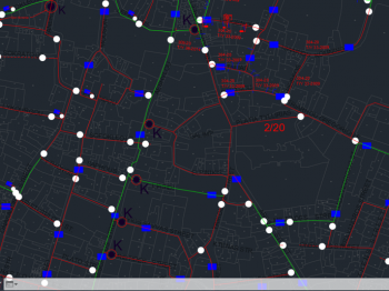
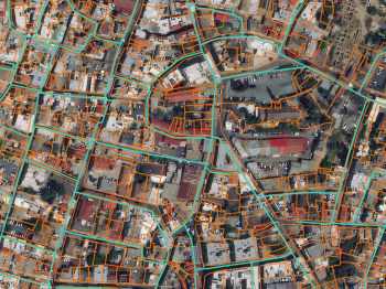
A GIS system was developed incorporating all the different data types in one editable, secure format. This allowed for the water distribution network of the area to be developed. The GIS system was combined with the results of a differential synthetic aperture radar (DInSAR) analysis in order to identify areas of increased displacement are at an increased risk of water leakages.
As a result of these efforts, and the comprehensive solution they yielded, the water authority could manage their assets electronically, via the developed system. Moreover, the organisation can now proactively mitigate water leakages, significantly reducing costs.
Highlights
- Legacy water network data was in different formats, and from different sources making it highly time-consuming to handle.
- Data, information, and drawings from different sources were obtained and made compatible on one GIS platform.
- DInSAR analysis illuminated areas of increased displacement in the water pipeline network, indicating to the authorities where to prioritise mitigation efforts.
- Many existing manual processes were automated allowing further efficiencies in data management.