Come rain or shine
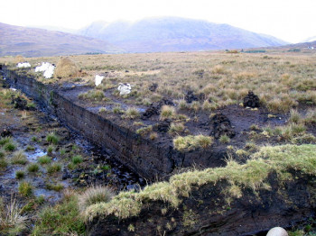
Soil moisture plays a pivotal role in contributing to various geohazards, including landslides, swelling clays, and sinkholes. The accuracy of susceptibility assessments for such hazards significantly improves with the inclusion of soil moisture as a variable. However, obtaining in-situ measurements of soil moisture across expansive areas is often impractical due to logistical constraints. In response to this challenge, our research, part of an ESA-funded study focussing on swelling clays, sought innovative solutions to derive indications of spatial and temporal variations in soil moisture.
Our approach involved the development of advanced algorithms designed to extract relevant data from satellite Synthetic Aperture Radar (SAR imagery) By leveraging SAR data, we could analyse large geographical areas remotely, providing valuable insights into the dynamic patterns of soil moisture. This not only enhanced our understanding of swelling clay behaviour but also contributed to the broader field of geohazard susceptibility assessments. The application of satellite SAR data and the development of tailored algorithms demonstrate the potential for remote sensing technologies to compliment traditional geotechnical studies, offering a more comprehensive understanding of environmental factors influencing geohazard occurrences.
Highlights
-
Soil moisture is a major contributory factor to most geohazards.
-
Algorithm developed to measure soil moisture with satellite and other data.
-
In-situ soil moisture sensors were installed in the ground to calibrate the algorithms.
-
Automated, regularly updated soil moisture measurements now available for the calibrated areas.