Validated Satellite Data
Validated mining-induced settlement data
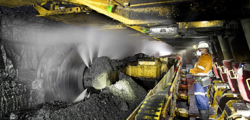
Longwall mining can cause ground subsidence over large areas, both during mining operations and long after they have ceased. If the subsidence becomes too large, it can affect both the natural environment and man-made structures, so it needs careful monitoring.
This example from Douglas Park, New South Wales, Australia, provided an opportunity to validate out InSAR output by comparison with in-situ surveying over a twelve-month period.
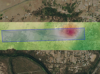
Ground surface settlement data over a wider area than could be achieved practically by conventional survey techniques were needed to monitor mining activity in the Douglas Park area of New South Wales, Australia.
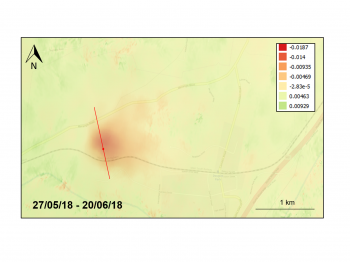
Historical satellite data was used to perform an InSAR analysis and provide surface settlement data over a large area of longwall mining. The existing conventional survey data over a long period provided us with a valuable opportunity to validate the satellite method.
Highlights
- InSAR analysis undertaken on time series of satellite images of the area.
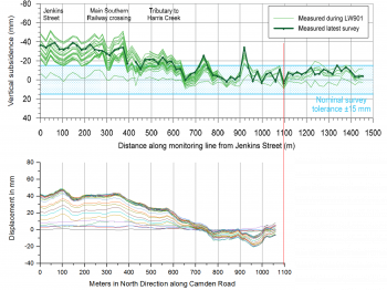
- Data on horizontal sections compared with conventional survey sections to validate the satellite method.
- The data obtained by the satellite agreed remarkably well with the in-situ data obtained by conventional manual level surveys.
- Moreover, the results sat comfortably within the nominal tolerance of ±15mm dictated by the conventional method.