Satellite remote sensing technology is rapidly advancing. We keep pace with developments and adapt them to meet the needs of infrastructure, mining, energy and insurance stakeholders. As well as satellite data, we add our engineering expertise to provide informed interpretation, validation and recommendations taking account of all additionally available information such as site investigations and engineering analysis.

Displacement measurement
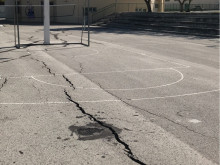
We apply differential interferometric synthetic aperture radar (DInSAR) techniques for displacement measurement and monitoring of assets with millimetric accuracy in both urban and rural environments. Outputs include vertical and horizontal (east-west direction) displacements every six days both retrospectively and for ongoing monitoring. We combine this with other topographical and engineering information to interpret the data and provide engineering insight.
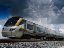
Cover your tracks
Learn how to get network-wide information on railway asset condition.
See Case Study

Soil moisture detection
We perform satellite image analysis to measure soil moisture changes over time – a key parameter in the assessment of susceptibility to geohazards such as landslides and expansive clays. It can also pinpoint locations of poor drainage or leaking water pipes allowing their proactive remediation before they cause costly damage to infrastructure.
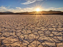
Come rain or shine
Soil moisture has a major effect on susceptibility to some geohazards. Learn how we measure it by satellite.
See Case Study

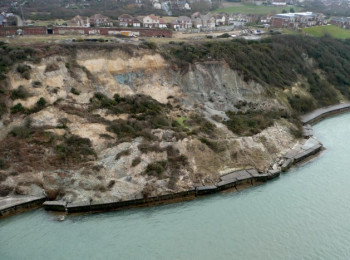
Forensic studies
DInSAR is the only method that allows the retrospective measurement of displacement because satellite images of the Earth’s entire land surface are being obtained and stored continuously. This makes it uniquely suited to forensic study and combined with our civil and geotechnical engineering expertise analysis, we offer interpretations of the data and further analysis to help identify the cause of engineering failures.
Establish Cause
Read how satellite data combined with engineering know-how helped establish the cause of bridge displacements.
See Case Study

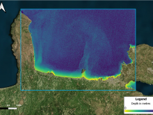
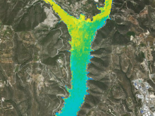
Bathymetry
We use satellite data to perform bathymetric surveys in shallow waters to help in the design of offshore facilities and dredging operations, as well as monitoring of seabed depths. The output is a depth measurement at every pixel of the satellite image which provides a dense array of measurement points.

Water quality
We monitor water quality using satellite data without the need for in situ measurements. We can determine water turbidity for eutrophication and sediment transport, chl-a concentration to identify water areas prone to eutrophication and to monitor algal blooms and other water quality parameters such as total suspended matter (TSM) and coloured dissolved organic matter (CDOM). All these parameters can be determined retrospectively or on an ongoing monitoring basis.
Clear blue water
Learn how to measure river, lake, reservoir and sea water quality by satellite.
See Case Study

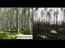
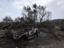
Post disaster mapping
Whether it is an earthquake, flooding, landslide or forest fire, we provide post-disaster mapping to determine the areas affected and the impacts. This is useful for estimating the severity and geographical extent of damages as well as for insurance, compensation and reconstruction purposes.

Research & Development
We have extensive research and development experience with strong links with universities, centres of excellence and enterprises. We have successfully implemented innovation projects for the European Space Agency, European Union, national governments and the commercial sector, for the development of state-of-the-art methods, products and services.
Landslide Susceptibility
Learn how a combination of satellite data with topographical and geological information gives more accurate landslide risk assessments.
See Case Study

Susceptibility mapping
We use satellite image analysis, geographical information systems, statistical analysis and engineering expertise to provide susceptibility mapping for geohazards such as landslides, expansive clays and sinkholes. The outputs are maps of susceptibility levels that may be used for planning, insurance and infrastructure asset management purposes.
Not Expensive, Just Expansive
The most costly geohazard globally is the humble swelling clay. Here's how to manage the risk.
See Case Study

Change detection
Satellite remote sensing is the only method that can be used for change detection studies. The availability of historical data enables the analysis of changes in both rural and urban environments as a result of human intervention. We determine the impacts of processes such as urbanisation, tourism, deforestation and beach erosion, over many years.