Coastal erosion
The coastline is moving.
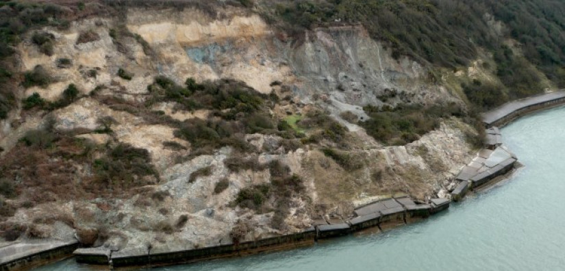
The erosion and landslides plaguing the south-west coastline of the Isle of Wight, UK, necessitate effective environmental management strategies. Differential Interferometric Synthetic Aperture Radar (DInSAR) emerged as a valuable tool for gauging the extent of cliff erosion and control efforts. This technique involves analysing a sequence of radar images to track alterations in ground movement.
Through comprehensive assessment of movement velocities, predictive insights can be extrapolated, enabling the creation of maps to evaluate the evolving rates of change. The amalgamation of satellite remote sensing methodologies, encompassing both optical and radar satellite data, facilitates the examination of historical shoreline transformations, including erosion rates. Leveraging this wealth of information, authorities can intelligently allocate resources, significantly reducing costs associated with traditional on-site surveys while effectively addressing the coastal challenges.
Highlights
- Perform Permanent Scatterers (PS) & Small Baseline Subset (SBAS) Differential Interferometric Synthetic Aperture Radar (DInSAR) analysis to measure displacements.
- Identify movement trends in the coastline in terms of differential settlement in millimetres.
- Pinpoint areas of concern (accelerating movements) in order to better deploy remediation measures and environmental defences.
Want to see how we generated a geohazard susceptibility map for landslides using similar methodology? Read this study from Cyprus next!
