We detect wind and wave direction and wave height from satellite data as well as environmental monitoring in offshore locations to meet permitting requirements. We also perform displacement monitoring of offshore platforms to detect subsidence.
Optimise operations, calibrate models and meet regulatory requirements with our remote measurement of ground elevation changes.
Monitor the condition of offshore (above water) infrastructure, onshore pipeline corridors and other support infrastructure regularly in a non-disruptive way. Use our engineering insight to identify defects before they become visually apparent for cost-effective proactive maintenance and avoidance of failures.
Keep workers safe and avoid operational disruption by obtaining condition and monitoring data remotely. Avoid long journeys to remote areas too, minimising your carbon footprint.
Energy infrastructure can be big, very big. So, construction and decommissioning often requires moving super heavy loads and supporting cranes over unsuitable ground or under-capacity support structures. Use our engineering expertise to apply more load than you thought possible.
Yes, we can even use satellites to measure storage volumes wherever in the world floating roof storage tanks are located.
From our Cyprus office, we provide local support with permitting studies, permit applications and maintenance, GIS services and environmental and offshore monitoring by satellite.
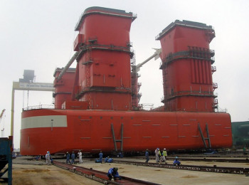
Read how advanced geotechnical analysis overcame a perennial loadout problem at a shipyard.
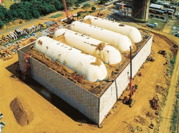
We'd be surprised if any piled raft foundation in the world were more optimised than this one.
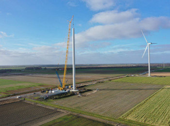
Read how the effect of a heavy crane load on adjacent piled foundations in soft ground was assessed.