Hidden depths
Bathymetry survey by satellite.
Remote sensing methods have the capacity to provide data on all kinds of topographical and geotechnical situations, and their operations are not limited to dry land. Optical and radar imaging techniques can also provide efficient and economical solutions for marine and coastal analysis.
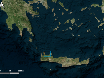
For the consideration of options for a marine development on the island of Crete, an up-to-date bathymetric survey of large shallow water area was required.
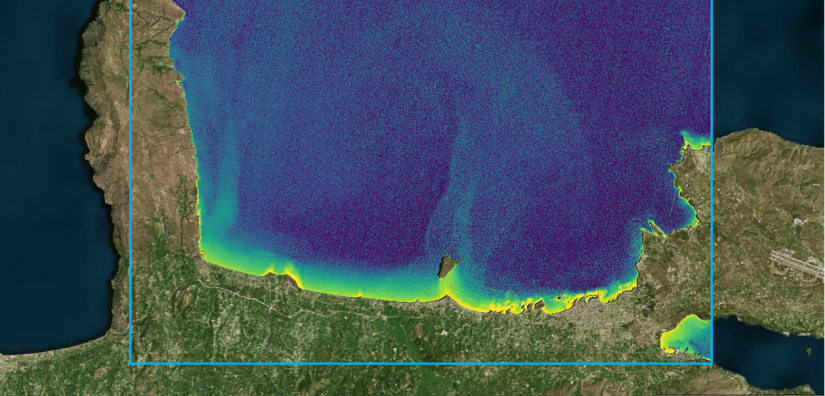
Bathymetry is an imaging technique that utilises satellite data to measure the depth of shallow water. Once processed, the satellite data can provide estimates of water depth at a pixel level. By assessing the changes in nearshore depth over time, the condition of coastlines can be more clearly detected.
Highlights
- A bathymetry survey was required for a large shallow water area off the north coast of Crete.
- Satellite radar data can be utilised to monitor shallow water depth by measuring the time delay between radar signals reflected from the water surface and the seafloor, allowing for accurate depth calculations.
- Water depth at every pixel location determined for wide coverage.
- The survey was completed in a fraction of the time an in-situ survey would have taken.
- Information gained from these studies allows for a multitude of benefits, for example, indicating the most suitable locations for the construction of ports.
- Moreover, authorities can use this knowledge to better allocate maintenance resources in a cost-effective way.