Clear blue water
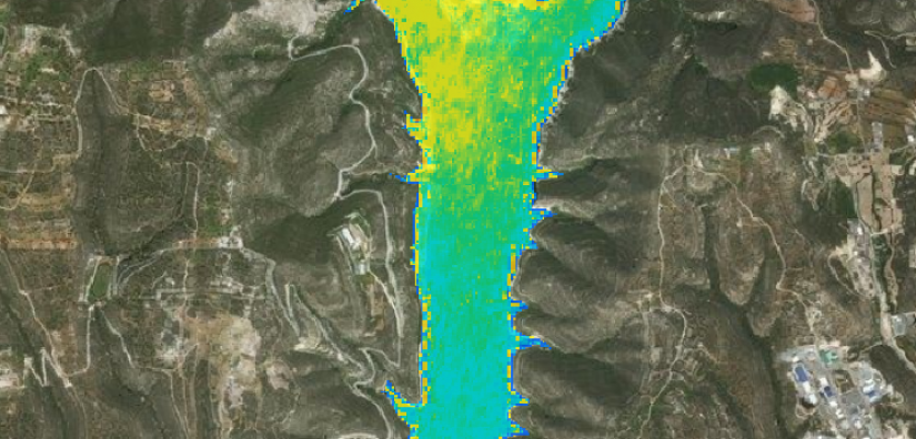
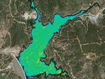
In the context of monitoring water quality, recent assessments for the Asprokremmos and Kouris reservoirs in Cyprus necessitated a non-intrusive approach, eliminating the need for traditional site vists, sampling endeavours, and laborious laboratory testing. Employing advanced satellite data analysis, a comprehensive time series was generated, enabling swift and remote measurements of crucial water quality indicators, specifically total suspended matter and chlorophyll-a concentration. This innovative methodology facilitated the rapid assessment of these parameters across almost the entire surface area of the reservoirs.
The utilisation of satellite technology in water quality monitoring represents a paradigm shift, offering a more efficient and cost-effective means of obtaining critical environmental data. The ability to analyse large-scale spatial and temporal variations in total suspended matter and chlorophyll-a concentration through satellite data not only expedited the assessment process but also provides valuable insights into the health and dynamics of these reservoirs. This remote sensing approach proves particularly advantageous in scenarios where access to the site is challenging or costly, demonstrating the transformative potential of satellite data analysis in environmental monitoring practices.
Highlights
-
Conventional water sampling and testing methods are slow and expensive and cannot be performed retrospectively.
-
A time series of satellite images was analysed to obtain regular data of total suspended matter and chlorophyll-a concentration.
-
Data from almost the entire surface area of the reservoirs was obtained without needing to visit the site.