Wildfire Risk
Measure forest fire risk
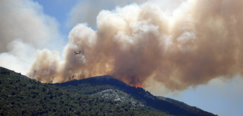
Measuring the risk of forest fires is pivotal in enhancing preparedness, ultimately leading to better control and minimized damage in the event of an outbreak. However, comprehending the fire risk over vast regions in real-time proves to be an immense challenge for on-site assessments.
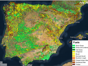
To address this challenge, satellite data plays a pivotal role by providing a comprehensive solution. It aids in generating daily fire danger maps, leveraging crucial data such as land cover, fuel conditions, dryness levels, and predictions of upcoming weather conditions. This amalgamation of data empowers the implementation of timely and location-specific fire prevention strategies.
The significance of this approach extends beyond proactive measures. The derived wildfire risk ratings from satellite-based fire danger maps serve as a crucial tool for bolstering preparedness in the face of fire emergencies. These maps also serve as a means to assess the extent of damage caused by fires post-outbreak. By harnessing the potential of satellite data, not only can the risks of wildfires be monitored effectively, but the aftermath and impact of such incidents can also be evaluated.
Highlights
- Wildfire risk ratings improve preparedness when fires do occur.
- Fire danger maps are produced daily based on satellite data.
- They use data such as land cover, fuel conditions and dryness combined with weather data predictions.
As well as being able to monitor the risks of wildfire, satellite data can also assess the extent of damage after fire. Read this case study to learn how.